You have explored the green and beautiful campus of the Asian Institute of Technology (AIT) many times. You have navigated the lanes and bylanes of the campus, and admired the flora and fauna. You have seen many maps and tagged your locations in Google Maps, Google Earth, SwarmApp and others. This time, come and explore the AIT in three dimensions, courtesy of a 3D rendering produced by AIT’s Geoinformatics Center.
3 dimensional rendition of the Asian Institute of Technology.
The 3D rendition is created after obtaining 1500 images of the AIT campus obtained in October 2017. “October is one of the best months since it is one of the greenest periods, and it is a good time to capture the resplendent glory of our green campus,” says. Dr. Manzul Kumar Hazarika, Director (Operations) of GIC. The drone flew at a height of 100 metres, and the images obtained had a resolution of 5 centimeter pixels traversing over the length and breadth of the campus seven times.
Following the capture of images, they were stitched together to create a 3D model.
The online 3D view of the AIT campus provides the user with a variety of options. The navigation mode allows a user to pan across the entire campus using a computer mouse as well as use the ‘orbit’ option to explore another dimension. While the default view enables a three-dimensional exploration, the wireframe option provides a schemata and a blueprint of the campus topography. Place the mouse at two ends, and it gives you the distance as the crow flies.
This is not the only such rendition that GIC has prepared. A few months ago, GIC demonstrated this technology to the Asian Development Bank (ADB), and prepared a 3D model of the ADB headquarters in Manila.
A 3-Dimensional rendition of AIT has been prepared by the Geoinformatics Center of the Asian Institute of Technology. The online 3D view of the AIT campus provides the user with a variety of options. The navigation mode allows a user to pan across the entire campus using a computer mouse as well as use the ‘orbit’ option to explore another dimension. While the default view enables a three-dimensional exploration, the wireframe option provides a schemata and a blueprint of the campus topography. Place the mouse at two ends, and it gives you the distance as the crow flies.
VIEW HERE: http://www.geoinfo.ait.asia/3d_models/AIT/App/#%2F
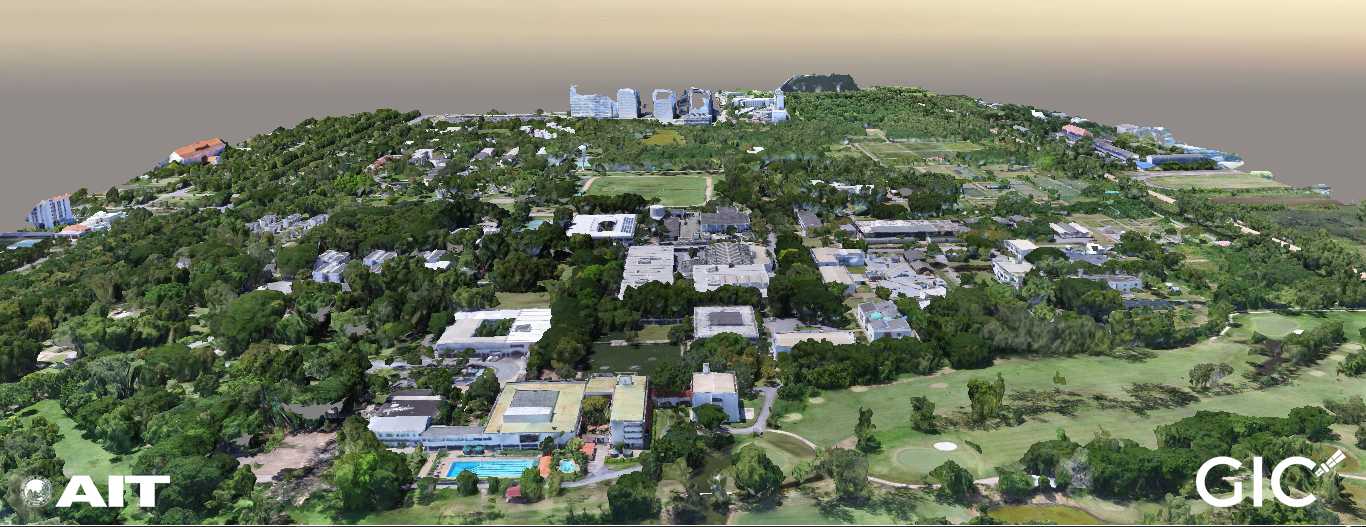
Rendition of the Asian Institute of Technology (AIT) in three dimensions.